A 64-year-old woman is facing felony counts of DUI and reckless driving after two pedestrians were killed in a bus stop crash in the east Las Vegas Valley.


A 64-year-old woman is facing felony counts of DUI and reckless driving after two pedestrians were killed in a bus stop crash in the east Las Vegas Valley.

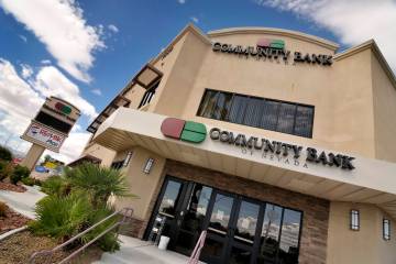
Plans include a complete renovation of the casino-resort and further development of 35 unused acres behind it.

A Las Vegas casino is bringing a Disneyland staple to the skies above downtown. Here’s when it will begin.

The Golden Knights lost to the Anaheim Ducks in the regular-season finale Thursday at T-Mobile Arena and fell to the second wild-card berth in the Western Conference.

The Golden Knights will begin their quest to win a second straight Stanley Cup on Monday. Check out the full schedule of their first-round series against Dallas.

Nevada’s highest court unanimously ruled that a state ban on ghost guns is constitutional, overturning a lower court’s decision.

North Las Vegas police responded about 11 a.m. to an apartment in the 3400 block of Mercury Street after reports of a child not breathing.

After seeing videos of the felon grabbing casino chips from tables, commissioners voted unanimously to place him on the List of Excluded Persons.

One of the Raiders’ few holes on defense is at cornerback. The good news for them is that this month’s draft class gives them plenty of options to fill it.

Two companies hope to have their platforms live in the state within the next year.

Fake pages on the delivery platforms direct orders to other restaurants. Acclaimed chef James Trees called out one of the pages in an online post.

The Nevada Supreme Court upheld a $48 million award to the owner of Las Vegas’ defunct Badlands golf course, as part of a long-running land-use dispute with the city.

A Family Court judge ordered attorney Dylan Houston to turn in his guns as part of a temporary custody agreement involving the man’s young children.

The Metropolitan Police Department is launching a pilot program to expand the use of drones in its daily operations.


Here’s everything you need to know about the Electric Daisy Carnival and other major music festivals coming to Las Vegas over a six-week span this spring.

Grammy-winning musician Gwen Stefani took the stage to the roar of 400 partiers at Ole Red Las Vegas on the Strip.

Final offers are being sought on a $159 million parcel that borders the Formula One Las Vegas pit building.

Two people are suspected of stealing more than $4,000 worth of pickleball equipment from a southwest Las Vegas Valley store by hiding paddles in their clothing.